จาก One_marlin@WBC56
IP:115.87.169.172
เสาร์ที่ , 15/10/2554
เวลา : 14:13
อ่านแล้ว = ครั้ง
 เก็บเข้ากระทู้ส่วนตัว เก็บเข้ากระทู้ส่วนตัว
 แจ้งลบ แจ้งลบ
 ส่งหาเพื่อน ส่งหาเพื่อน
|
1. แผนที่แสดงจุดเกิดอุทกภัยบนทางหลวงทั่วประเทศ (ขัอมูลอัพเดตทุกวัน เวลา 10.00 และ 19.00 น.)
Highway flooding location (daily update on 10:00 & 19:00)
http://maintenance.doh.go.th/test.html
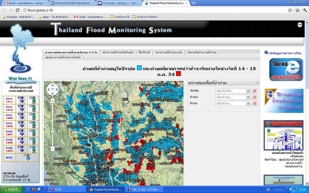
2. ตรวจพื้นที่น้ำท่วมทั่วประเทศ
Nationwide Flooding Location
http://flood.gistda.or.th/
3. ตรวจน้ำท่วมบนถนนใน กทม.
BKK Road Flooding information
http://dds.bangkok.go.th/Floodmon/
4. รายงานสภาพการจราจร
BKK Traffic information
http://traffic.longdo.com/
5. ตรวจวัดระดับน้ำในคลองหลัก
Water Measurement Information (6 BKK Major Canal)
http://dds.bangkok.go.th/Canal/index.aspx
6. ติดตามข่าวสารน้ำท่วม
Flooding NEWS
http://dds.bangkok.go.th/m/index.php
7.กรมทรัพยากรน้ำ
Department of Water Resources
http://www.dwr.go.th/report
8.กรมทางหลวงชนบท
Department Of Rural Roads
http://fms2.drr.go.th/
9.ศูนย์ประสานการช่วยเหลือผู้ประสบภัยพิบัติ
Flooding Help/Rescue Information
http://www.thaiflood.com/

|


